

Cotlette Bois
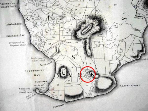
The lands of Bois Cotlette are located between the letters 'R' and 'K' in the words ST. MARK, on this map. It is based on a survey carried out by a British team during the 1760s led by John Byres and it was published in 1776. It is known as The Byres Map.
[Die Quelle: Lennox Honychurch's Dominica]